More than two-thirds of Morocco’s northern territory is covered in mountains, including four unique mountain ranges to explore off the beaten track. The mountains offer a marvelous rugged landscape rife for exploring and the perfect playground for thrill seekers.
The Rif
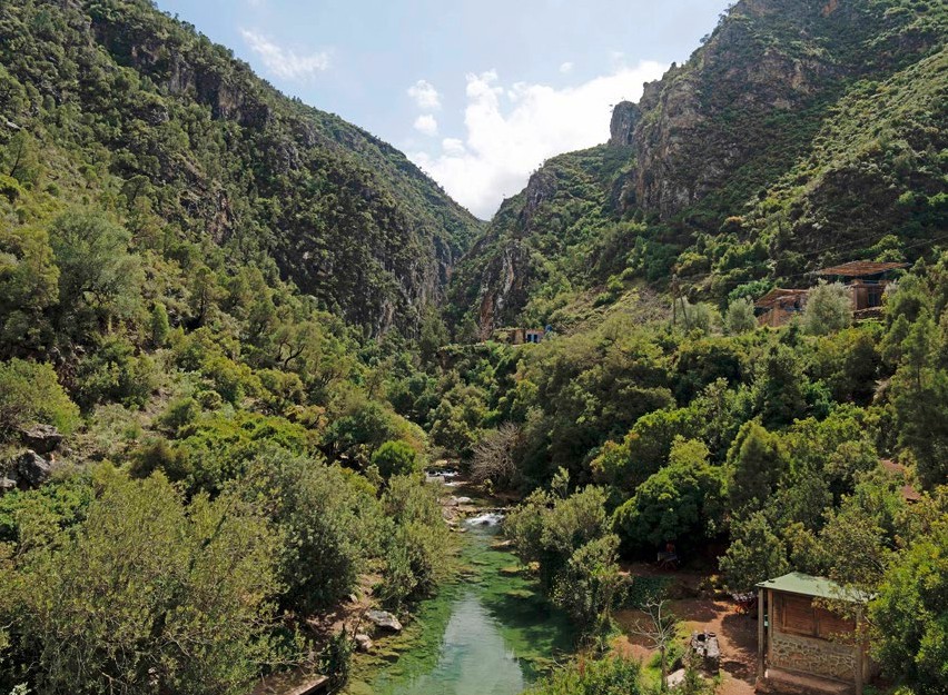
The Rif Mountains sit in the most northerly part of Morocco’s mountain chains, great for hiking and close to the popular tourist towns of Tangier, Chefchaouen, the Andalusian inspired city of Tetouan or the quite pearl city of Al Hoceima and the Marchica Lagoon of Nador. The walking trails here take hikers through picturesque Amazigh villages and cedar forest in the Talassemtane or Al Hoceima National Parks and the Moulouya’s Site of Biological and Ecological Interest, said to be the greenest mountains in Morocco.
Right in the middle of these sites lie stunning hidden gems, popular for visitors who like to trek in valleys and mountains, in around three to four hours. The trails are surrounded by many forests and includes numerous small cascades, and rocks and tree stumps covered in moss that become a thick jungle with the sound of trickling water and birds singing it makes for a serene walk in the vast outdoors. Once at the shores of the Mediterranean visitors can take a dip in its mid-cool waters and marvel at the majestic mountains that go down into the sea.
The Middle Atlas
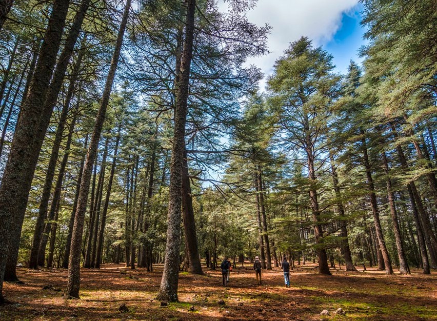
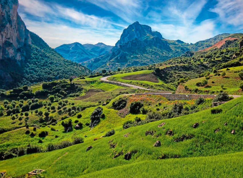
Between Fez and Beni-Mellal, the Middle Atlas area has gentler slopes with wooded hills offering excellent trekking. It covers 14,292 square feet (23,000 square kilometres) and takes in the provinces of Khenifra, Ifrane, Boulmane, Sefrou, Khemisset and parts of Taza and Beni-Mellal. The mountains are covered with evergreen oak and cedar forests, with fertile lands and lakes scattered around it.
Khenifra, on the Oum Er-Rbia River, is designated ‘the doorway to the Middle Atlas’ and is a region renowned for its lacs, named Aguelmane in Amazigh, bordering on the mountains until Beni-Mellal that is rich in monuments from the Moulay Ismail period and the Almoravids. In Ifrane between Fez and Meknes, the mountains form a dream backdrop for the Ifrane National Park at an altitude of 5,410 ft high (1,650 m). Known as ‘Little Switzerland’, Ifrane is a place for winter sports and is covered in snow from mid-November. Whether visitors are amateur skiers or experts, there are several ski slopes to try as well as horse riding, mountain biking and tree climbing.
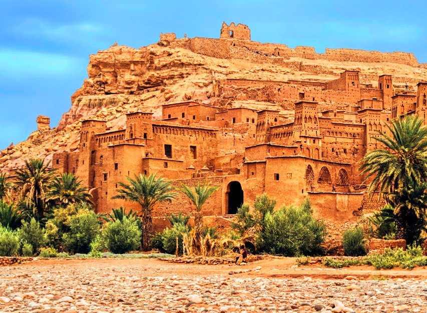
Azilal, lies in the foothills of the Middle Atlas and at the junction of the High Atlas, and is the capital of the M’Goun Conservation Area, a perfect base point to explore the region. It is also home to the M’Goun Geopark Museum, a region of fossils of Mesozoic age and stone structures and the well- known Cascades d’Ouzoud waterfall. Tourists also gather around the popular dinosaur statue built here, which is lit up at night time and surrounded by waterfall.
The High Atlas
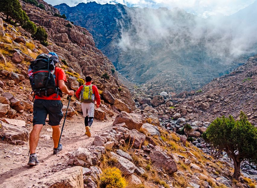
The High Atlas forms the highest part of the Atlas Mountains of Morocco, it rises in the west at the Atlantic Ocean and stretches east to the Moroccan- Àlgerian border. Jbel Toubkal is the highest peak at 13,671 ft (4,167 m) that lies in Toubkal National Park, acting as a weather system barrier separating the Sahara Desert from the northern fertile areas. The snow-covered mountain tops last into late spring and there are ski stations including at Oukaimeden for winter sports fans (50km south of Marrakech).
Inhabited by Amazighs offering unparalleled hospitality, the valleys of the mountains offer a great spot for tourists to hike. In the northern reaches of the High Atlas Mountain sits Ait Bouguemez, or ‘happy valley’ as it is known, offering high-cultivated plateaus such as Mgoun, Rat or Azourki peak.
Lake Ifni also sits in the middle of the valley of these mountains, at 6,560 ft high (2,000 m), offering a peaceful camping opportunity with apocalyptic sunsets and sunrises. For a more serene water sport, why not try paddle boarding or swim in the cool waters.
For adventure lovers wanting a challenge, Mount Toubkal, the highest peak in northern Africa, is physical challenging achievement that can take two to three days to trek. Those who reach the summit are blown away by the panoramic views and the quiet surroundings.
The Anti-Atlas
Also known as, the Little Atlas, the Anti-Atlas is a smaller mountain covering a distance of 311 miles (500km), with heights up to 10,840 ft (3,304 m), at Jbel Sirwa, and are covered with thyme, rosemary and argan. The Anti-Atlas is sparsely inhabited and sits close, west by east, to Tafraout, the Draa Valley, Ouarzazate and Tinghir. Its main town is Tafraout, which is described as ‘Morocco’s Amazigh heartland’ and visitors will be able to view ancient cave paintings in certain areas of the mountain range close to it.
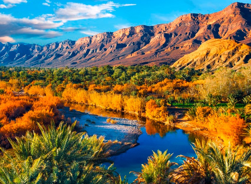
Stretching from Ouarzazate into the Sahara Desert, the breathtaking Draa Valley is a hotspot for visitors who can explore the Amazigh villages, Kasbahs, streaming sand dunes, endless palm trees and Morocco’s largest river, The Draa, now mostly dried up. It was near the river mouth on the Atlantic where archeologists found the statuette of Venus of Tan-Tan, one of the oldest prehistoric sculptures ever discovered.
The region is distinguished by rare and endemic species including gangas, sirlis, gazelles, hyenas and foxes that can all be found in the mountains. While rock climbing, motor cycling treks and mountain biking are all great sports for thrill seekers.
Beni-Snassen Massif
In the northeast of Morocco, is a smaller mountainous region of low altitude. Beni Snassen Massif is spread across Oujda-Angad, Berkane and Taourirt and its stunning limestone mountains reach a height of 5,036 ft (1,500 m). It is one of five sites in Morocco to be identified as a study site of biological and ecological interest.
For nature lovers, it provides a variety of evergreens and fragrant herbs, watered by numerous springs. Large vineyards adorn the slopes alongside Amazigh tribes that live in the small villages dotted along the foothills of the mountains.
Tourists can visit a number of caves including Grotte des Pigeons, in Berkane, where the earliest stone-age skeletal remains were discovered or Grotte du Chameau an ancient network of limestone and dolomite caves once used by early homo sapiens and set in a mountain that resembles the shape of a camel.
The road through the mountains includes deep gorges and fruit plantations including orange groves, citrus fruit and fig trees.
Morocco Tour Packages
Leave a Reply